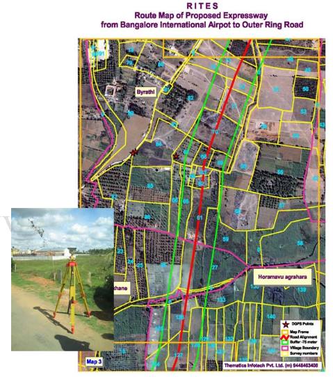
The Project was executed using two Sokkia DGPS Dual Frequency Receivers. Six pair points were established at regular intervals along the corridor. The details of the locations of each of the DGPS Control Points was listed individually in a detailed report.

After the establishment of DGPS Control Stations, a detailed walk through survey was carried out along with the topographical survey team to mark the centerline of the proposed expressway. The GIS database of the entire proposed corridor was uploaded onto a GPS enabled GIS digital field book and the centerline of the corridor was tracked on the ground. The indications of the centerline were marked on several permanent features all along the corridor.
